Synchronizing CAD With Physical Reality.
We map your site, align your design, and stake it out for flawless construction.
| Design | Staked | Δ m | |
|---|---|---|---|
| N | 4 785 412.318 | 4 785 412.322 | +0.004 |
| E | 593 201.774 | 593 201.768 | −0.006 |
| Z | 212.450 | 212.457 | +0.007 |
Weekly Drone Topo/Datasets Seamlessly Paired With Centimeter-Accurate Ground Stakeouts.
We stake out civil site works: curbs, sanitary manholes, storm catch basins and every structure on the plan. RTK rovers on live corrections put your design on the ground, so crews dig and pour straight from the drawings. First time, no rework.
Curbs & Roadworks
Back of curb, radius points and grade.
Sanitary
Manholes, inverts and service connections.
Storm
Catch basins, manholes and pipe runs.
Anything On The Plan
If it's got a location, we'll find where it goes.
Why Four Points Geospatial
Next-Day Turnaround
We deploy within days, not weeks, completely eliminating the standard project bottlenecks.
Zero Construction Delays
No site closures, so your crew keeps moving instead of waiting around on data.
One-Man Deployment
We cut crew requirements in half, making our on-site footprint safer and more efficient.
Massive Cost Savings
Smaller crews, no site closures and fewer return visits mean you pay for less time on every job.
Instant Digital Access
Immediate cloud access to the data, reducing unnecessary site visits.
Live Progress Tracking
You receive continuous as-builts and progression updates instead of waiting for the end of the job.
CAD To Construction
Drone topo and RTK survey points give us the existing surface. Your CAD goes on top, and we stake it out to the centimetre. Real jobs, real screens.
- 01 · The Topo
CAD And Survey Data
The site, the design and every topo point, lined up before we go.
- 02 · The Stakeout
Staked In The Field
RTK rover on live corrections, staking out for installation.
- 03 · Job Progression
Daily / Weekly Updates
Topos, visuals, as-staked reports and site awareness as the job moves.
The Rest Of The Toolkit
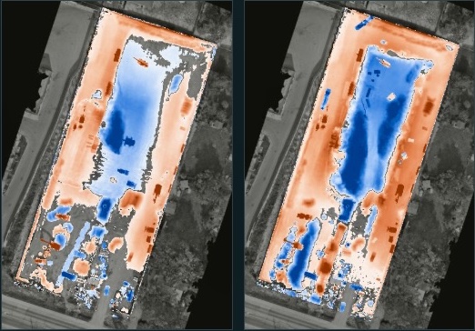
Mapping, Topo & Construction Intelligence
Orthomosaics, point clouds, DEMs and volumetrics, plus progress flyovers and stockpile reports. RTK-corrected, centimetre-accurate.
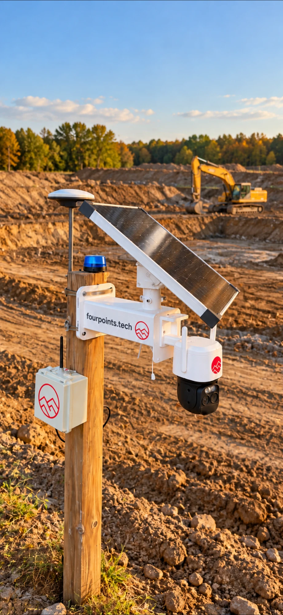
Off-Grid Security & Monitoring
Solar-powered cameras, networking hardware and monitoring for sites with no power or internet.
Media On YouTube
Project walkthroughs, aerial timelapse and digital twins. See the work in action.
Live Corrections. No Base Setup On Site.
Zero Disruptions.
Our rovers and drones run on GEODNET corrections streamed over NTRIP, so every point we stake or capture is tied to the same centimetre-level reference.
We install, own and manage our own RTK base stations across Ontario, so the corrections our crews rely on are under our control.
- BaseRTK base stationGEODNET stations across Ontario feeding a global corrections network.
- FixCM-level GNSS correctionsAbout 2 cm positional accuracy, streamed live from the nearest base.
- NTRIPRovers and dronesCorrections reach our rovers and aircraft over NTRIP.
- ProcessProcessingSurvey-grade datasets, fully georeferenced.
- DeliverDeliverablesStakeout reports, orthos, point clouds and DEMs, stored on ANCHOR.






Got A Site To Stake?
Send the address and what needs laying out. We'll come look, free.