We're deploying a network of GEODNET RTK mining stations across Ontario — contributing centimeter-level GNSS correction data to decentralized positioning networks while generating revenue from every station. This is infrastructure-level innovation. It's not about one operator's accuracy — it's about raising the floor for the entire industry.
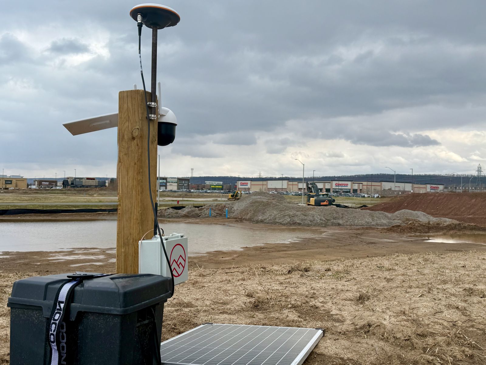
RTK Base Station
GEODNET decentralized mining stations deployed across Ontario — contributing to a global corrections network
CM-Level GNSS Corrections
~2cm positional accuracy streamed in real-time from the nearest base station
RTK Drone Fleet via NTRIP
Corrections delivered to our aircraft over NTRIP protocol — no manual base setup required on site
Processing
Survey-grade datasets processed through our pipeline with full georeferencing
Deliverables
Orthomosaics, point clouds, DEMs, volumetrics — stored on our ANCHOR private data server
Want to learn more?
See how RTK-corrected data can transform your project accuracy.
Request Site Visit